Looking under the lamppost
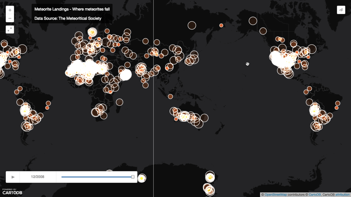
Harkanwal Singh, at the Herald, has a very nice animation of known meteorite locations around the world and over time, as part of the report on Wednesday night’s fireball. Here’s a still of the last frame: click to expand.
 ,
,
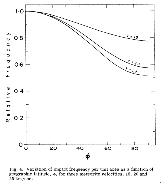
This is basically a map of sampling bias. That is, meteorites hit the Earth uniformly by longitude and over time, though with a preference for the tropics over the poles. The bias towards the tropics is fairly slight by real area, but the Mercator projection will amplify it. From a 1964 paper by Ian Halliday:
That’s not what the map looks like.
The first part of the sampling bias is that a meteorite basically has to hit land to be counted: if it hits ocean it will sink without a trace.
It’s easier to find meteorites in places where they don’t bury themselves in soil or get eroded, so we see lots of them in desert or in ice. You don’t get many found in the Amazon, but there are lots just to the west in the Atacama desert of Chile.
In non-ideal circumstances it helps if there’s a fairly dense population of observers and scientists: meteorites in the modern US have a reasonable chance of being found even in non-ideal countryside. And finally, some places are easier to search than others. There’s a sharp drop off in meteorite finds between Oman and Yemen. This isn’t due to a dramatic geological or weather boundary; it has the same causes as the 13-year difference in life expectancy.
Thomas Lumley (@tslumley) is Professor of Biostatistics at the University of Auckland. His research interests include semiparametric models, survey sampling, statistical computing, foundations of statistics, and whatever methodological problems his medical collaborators come up with. He also blogs at Biased and Inefficient See all posts by Thomas Lumley »