Auckland in sepia
Auckland went impressively dark just before 2pm this afternoon: from Christina Hood on Twitter:
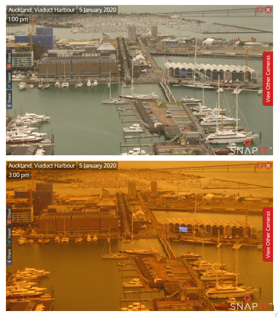
The reason is smoke from the Australian bushfires.
Fortunately for Auckland, the smoke (at the moment) is mostly at high altitude; you can tell because the lower picture is about as clear as the upper picture, just darker and more orange. Fine air pollution particles scatter light very effectively — in places with less humid summers than Auckland, light scattering is a good way to measure how much there is.
We can also look at the hourly measurements of PM2.5; fine-particle air pollution, or, basically, smoke. Here are data from Penrose, in south central Auckland.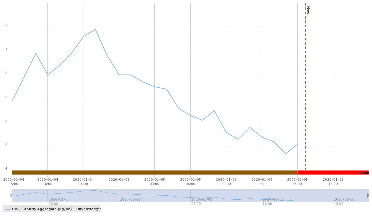
and Patumahoe, in far south Auckland
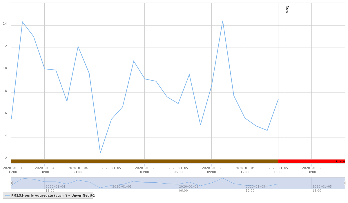
I chose these two because they were available and because there won’t be that much NZ-origin air pollution at those sites (on a Sunday afternoon). At both locations there’s been an increase in fine particle air pollution, but not to any level of health concern. It might be worth looking later in the evening, if you’re worried. Given the placebo effect, if you don’t have specific health concerns you might be better off not checking.
(The Environment Auckland permalinks don’t work, so you need to go here and then to the AQ locations link, and then drill down. You want “PM2.5 Hourly Aggregate unverified”)
This smoke used to be trees, 2000km away. We’ve seen particles from further than that — the Puyehue-Cordon Caulle volcano in Chile disrupted flights in 2011 — but the density of this smoke is much, much higher. WeatherWatch doesn’t know of a precedent.